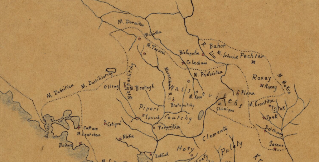
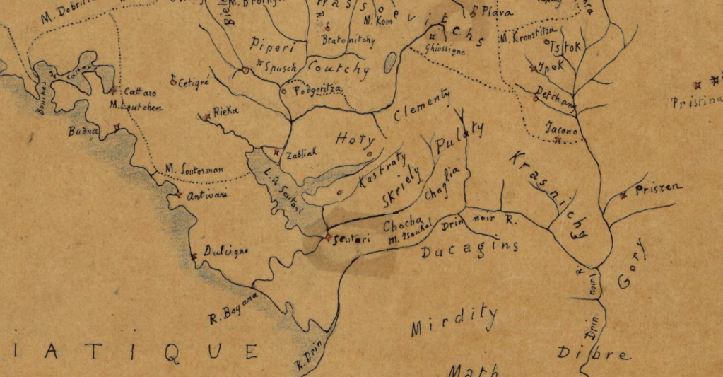
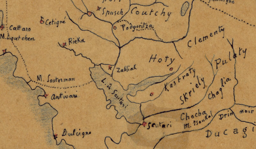
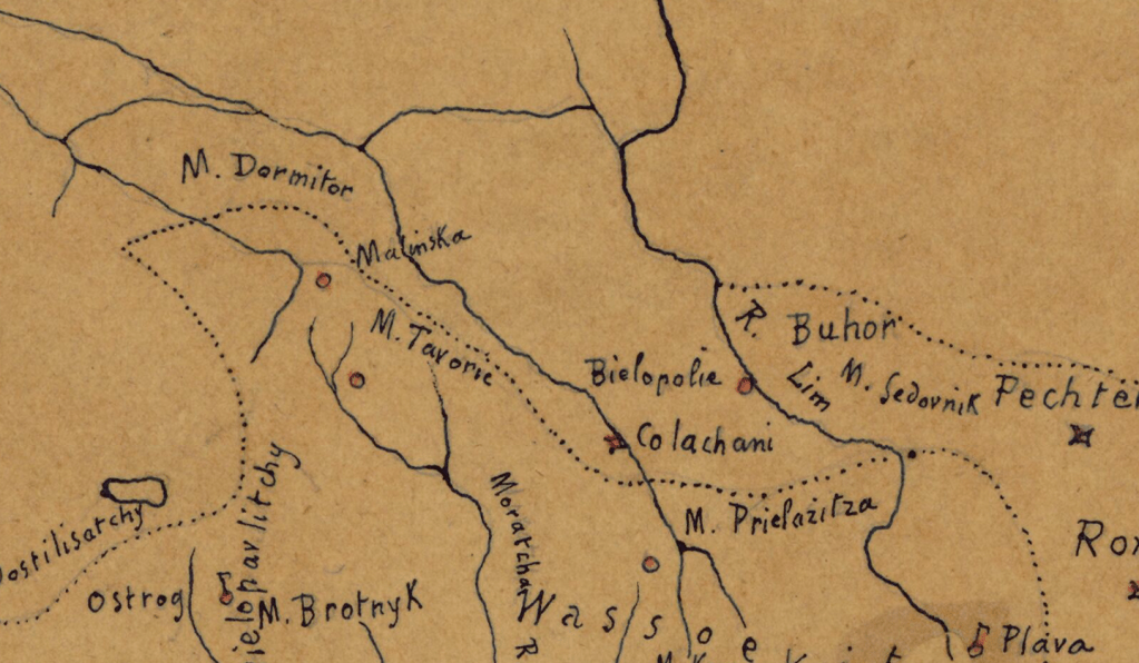
This is one of the rarest historical maps with a title in French that had no better maps than this: Carte des Tribus Indépendantes et des Tribus Belligerantes de la Haute Albanie”, which in Albanian translates as: Map of the independent tribes and warring tribes of Upper Albania.
This is the history of Montenegro until 1838. The map was made in 1839, at a time when the Albanian lands were still organized into independent tribal communities, outside of full Ottoman influence. The author of this map is Gr. Dapsan, as can be read in the lower left part of the map. It clearly shows the Albanian tribes of the North: Hoti, Gruda, Kelmendi, Shkreli, Kastrati, Dukagjin, Krasniqa, Gashi, Bytyci and many others.
All the tribes in the map
- Hoti
- Gruda
- Kastrjoti
- Klementi
- Pulaty
- Shkreli
- Drekali
- Piperi
- Bjelopavlici
- Boshkovići
- Bratony
- Vasojevići (Vassoievitchs)
- Kuči
- Rovasy (Rovaci)
- Krasta
- Krasniq (Krasniqui)
- Dukagjini (Ducagins)
- Mirditë (Mirdity)
- Shala
- Shoshi
- Gashi
- Bytyqi
- Kelmendi
- Berisha
Screenshots of the map zoomed in.