by Dr. Selman Sheme. Translation Petrit. Image from gazeta-nacional.com.
“190th anniversary of the publication in Camëri of Qirjako Dhimitër Kutra’s text “Description of the Geography of Albania”
On the occasion of the 190th anniversary (year 1832) of the publication in Camëri of Qirjako Dhimitër Kutra’s text “Description of the Geography of Albania”, the first text to date on the Geography of Albanian lands.
During the Renaissance period, great achievements were recorded in regional geographical studies. During this period, efforts were made to organize studies in small geographical units, initiating the regionalization of geographical space. The state administration cooperates with researchers to carry out the administrative division of a state based on rational criteria.
The provision of each separate state with its own physical, political, economic, and administrative geography text, according to the tradition already sanctioned since the 18th century, also occurred in the Pashalik of Ioannina
During the reign of Ali Pasha Tepelena, the first work on the Geography of Albania was written by Qyriako Dhimitër Kutra, which also provides demographic data for Epirus (Chameria).
Despite the fact that the Pashalik of Ioannina was overthrown in 1822, its existence for 30 years left deep traces in the Albanian, Balkan, and European public opinion. Although it was not recognized de jure as an independent administrative formation, the Pashalik of Ioannina created the impression of a separate state.
The initiative to compile the geography of the Pashalik of Ioannina was taken by an Epirote scholar originally from the Ionian island of Cephalonia, Athanas Psalidha. Psalidha is the author of the book “Description of the Geography of Epirus”, written in Greek.
Supported by Ali Pasha Tepelena, he directed the Kapllanos College, a Greek comprehensive school that flourished during the time of the Pasha of Ioannina.
In the text “Geography of Turkey”, Psalidha treated the geography of Epirus in a separate chapter. In this chapter, Epirus is treated according to the ancient historical perspective, as a territory that began in the Gulf of Preveza and ended in the Vjosa River. He treated Epirus as a separate province, separated from Greece and Albania. Thus, the “Geography of Epirus” written by A. Psalidha had the appearance of the geography of a state.
A student of Athasan Psalidha named Qyriako Dhimitër Kutra, from the village of Suhë in Lunxhëria, continued the work to complete, correct and modify Psalidha’s text on the “Description of the Geography of Epirus” according to the needs and requirements of the time.
Qyriako Dhimitër Kutra was born in 1780, he received his primary education in Greek in the village of Dhrovian (Delvinë).
When he grew up, he became a hierodeacon (Orthodox monk). With the scholarship that Athanas Psalidha provided him, he attended the school of Kapllanos in Ioannina, which he completed in 1815 when he was 35 years old. In this school in Ioannina, Qyriako Kureta, when he became a podeagog, taught the subject of Geography of Epirus.
Later he taught in other cities of the Pashalik of Ioannina, including the Platonic school of Përmet and finally in the “Zosimea” gymnasium of Ioannina, founded in 1828. His text, written in Greek, was published under the pseudonym Kozma Thesproti and is entitled “Supplement to the Geography of Athasan Psalidhës”.
Meanwhile, he compiled, as an appendix to the “Geography of Epirus”, a special geographical text for the Albanian regions that extended north of the Vjosa River to the districts of Ulcinj and near Bosnia. In this work, he also used the pseudonym Kozma Thesproti.
He titled the work “Description of the Geography of Albania”. “The Geography of Albania” by Kozma Thesprot alias Qiriako Kutra is an interesting work not only in terms of its content, but also in terms of the motive that prompted this Albanian monk to compile the first text known to date on the geography of Albanian lands, despite the fact that it does not reflect all Albanian lands.
The separate use of the two geographical names, Albania and Epirus, does not mean at all that we are dealing with two different ethnic state formations – one Albanian-speaking and the other Greek. A careful reading of both works convinces us that Qiriako Kutra saw the Pashalik of Ioannina, like the vast majority of foreign observers, as an Albanian state formation. This is evidenced by two facts:
First, the appellation Epirus had long since become identical with the appellation Albania (Albania).
Secondly, Qyriako Kutra saw the geography of Epirus as an appendix and part of the geography of the entire Albanian region up to the border with Serbia and Montenegro.
The region named Epirus has also been considered by many other scholars as part of the Albanian geographical space. It has now been proven that the geography of Albania was born in Chameria, at least as a school textbook in 1832. The pseudonym Kozma Thesproti is considered an attempt by the Albanian monk Qyriako Kutra to oppose the Greek monk Kozma Etoliati or as he is known, Saint Kozmai, who a few years earlier had been fighting to convince Orthodox Albanians that they belonged to the Greek nationality.
In 1936 Kozma The scholar, alias Qyriako Kutra, interrupted his educational activity after being transferred from Epirus to More. This transfer was a punishment for him, perhaps because of the content of the textbooks. It seems that the geography textbook was deliberately written for the students of the Përmet plot, founded with the funds of the Përmet resident Zoto Pano Duro in 1778.
This school was born in the war with Ottoman reaction and Phanariot dogmatism, which did not allow it to develop, and persecuted its author.
From the point of view of geographical data, the textbooks for Albania and its southern region, Chameria, are very poor. The author does not define or separate Chameria from an ethnic point of view. He was a monk of the Orthodox Church.
As a student of Paslidha, he divides the population of Epirus into Turks (Muslims) and Greeks (Christians). He writes that in the Margëllić district there were a total of 3500 houses. Of these, 1600 were Muslim, 1500 Christian families. While in the center of the district there were about 400 houses. Likewise, in the district of Parathimija, it is said that a total of 4000 families lived, of which 2000 were Muslim houses, 1000 were Christian, and in the center about 1000 houses.
In the Geography of Kozma Thesprot it is said in a summarized manner that in the province of Fanari there were 22 Christian villages, with 400 houses, among them, Gliqia, the center of Fanari, had 20 houses. The province of Parga, with four villages, had 300 Muslim and Christian houses. It is understandable that the Muslim families belonged to the Albanian ethnicity, since it is known that there were no ethnic Turkish Muslims in Chameria.
The identification of the Christian Cham inhabitants is difficult, since the term “Christian” included not only Greek speakers, but also Albanian and Vlach speakers. From the data available from foreign authors and researchers, the conclusion emerges that throughout historical Epirus, from the Gulf of Preveza to the Vjosa River, the majority of the population was Albanian.
In the districts of Filati, Margëllëç, Parathimija, Gumenica and Preveza, the majority of the population was Muslim Albanians, followed by Orthodox Albanians, while ethnic Greek inhabitants represented a low percentage.
Detailed information on the size of the population, the ethnic and religious structure of the Vilayet of Ioannina, which also included the region of historical Epirus (Çamëria- S.SH.) is provided in his works by the Hellenic-Epirotic chronicler P. Arvantinoi. Panajot Arvantinoi is the first Greek scholar who, in addition to the ancient name Thesprotia, also uses the popular Albanian appellation “Çamëri-Çamëria”.
He has published two volumes with documentary and chronicle data on Chameria during the medieval centuries. Both volumes bear the same title: “Chronographia e Epirit” (Chronographia tes Epireu), Vol. I-II published in Athens, in 1856. Arvantinoi lived and worked in Epirus (Çamëri), and for some time he even served as a geography teacher in Preveza.
The second volume of Arvantinoi’s work describes in an encyclopedia form the settlements of Epirus throughout history. This author lists in his works all the settlements of the Vilayet of Ioannina, divided into sanjaks (tmema) and these into kaza (diocese) or nahiye (periochi) and for each settlement (village or city) he gives the number of houses, the language spoken by the inhabitants and their religious beliefs.
From this detailed information of the Hellenic-Epirite chronicler we learn that in the middle of the 19th century, 78,371 families lived in the Vilayet of Ioannina, of which 47,066 were Albanian families (60%) and 31,305 Greek and Vlach families (40%). Of the Albanian families, 47,066 families were Muslim and 11,723 Orthodox families.
These figures also include the inhabitants of the southern regions of present-day Albania (the inhabitants of the kazas of Vlora, Berat, Skrapar, Tomorrica, Përmet, Tepelena, Gjirokastra, Delvina and Saranda). From the Arvantinoi census it appears that in the sanjak of Delvina, which included a considerable part of Chameria, Albanians constituted the majority in all its kazas. Thus, the kazas of Delvina, Filati, Paramithi, Margëllëç and Fanar had a total of 13,217 Albanian families and 7,030 Greek families.
Although Arvantino’s work contains a lot of demographic statistics, it is difficult to determine the exact population of the geographical area of Epirus (Chameria). On the other hand, Ottoman statistics are not helpful either, since for the countries that emerged from the Ottoman occupation they are poor in demographic statistical indicators, because the administrative divisions did not match the ethnic borders of the peoples.
From rough calculations it appears that in the second half of the 19th century Chameria had a population of over 150,000 inhabitants.
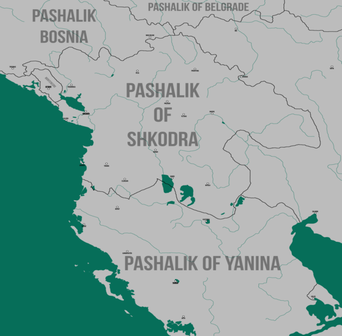
In the 1980s, the Albanian ethnic areas were divided into four vilayets: Shkodra, Kosovo, Manstir and Ioannina. These large administrative units remained almost unchanged until the declaration of Independence.
In the middle of the 19th century, the Albanian ethnic area occupied an area of 75,000 km2. It extended north to Sutomoro, north of Tivar, Rožaje and Novipa. zar, in the northeast to Niš, Leskovac and Vranje, in the east to Kumanovo, Skopje and Manstir, in the south to Konica, Ioannina and Preveza.
In 1850, these four vilayets had a population of about 1,700,000, while in 1912 there were approximately 2,354,000 inhabitants. Of the 2,534,200 inhabitants, 61.7% were Albanians, 13.5% were Macedonians, 7.3% Greeks, 6.9% Serbs, 5.3% Turks, 5.4% Vlachs and 0.1% other. In the Vilayet of Ioannina, where the province of Chameria was also located, Albanians represented 59.1%, Greeks 24%, Vlachs 10.4% and others 1.1% of the total population.
Our distinguished scholar Sami Frashëri, in his major work: Kamus-ul Alam (Encyclopedia of History and Geography) in the section Arnavutlluk (Albania), treats Chameria as part of Albania. He writes:
“The southwestern coast of Albania, called Chameria, consists of hills, has a mild climate. It presents the appearance of a paradise, with olives, oranges, lemons and beautiful winter pastures. In the interior there are very beautiful valleys between the mountains, plateaus and high plains, like that of Ioannina”
For Sami Frashëri, Albania began in the south from the Gulf of Arta (Gulf of Preveza) at that time on the border with Greece, in the north to the old border of Montenegro and the present-day borders of Bosnia and Serbia and from the eastern coast of the Adriatic and Ionian Sea in the west to the border with Bulgaria, in the lower bed of the Vardar River in the east.
Sami defines Chameria from the Miçikeli mountain east of Ioannina to the shores of the Ionian Sea in the west. Among the main cities of Albania, Sami mentions Ioannina after Shkodra, Prizren and Monastery. Each of them had over 30,000 inhabitants. Among the second-class cities in Chameria, he mentions Preveza, with over 10,000 inhabitants, as well as the cities of Filati, Ajdonati (Paramithia), Margellici, Parga and Gumenica.
The most fertile areas of Albania are the Myzeqe plain and the most beautiful places are Chameria in the southwest. From 1847 to 1913, 17 ethnogeographic maps of the Balkans and the ethnic distribution of Albanians were compiled and published. Objective researchers such as G. Lejem, P. Bradashe, C. Sax, F. Nopcha, etc., present Chameria as part of Albania.
Although the area of the ethnic core had an area of 52,000 km2, based on the unjust decisions of the Conference of Ambassadors in London (1913), the newly formed Albanian state was left with only 28,748 km2. The rest was divided between Serbia, Montenegro and Greece. Greece was given Albanian lands up to Preveza (about 5,000 km2) where Albanians were the overwhelming majority. The Albanian national movement is still an unfinished mission in our days.
Reference

