by Damir Dibra
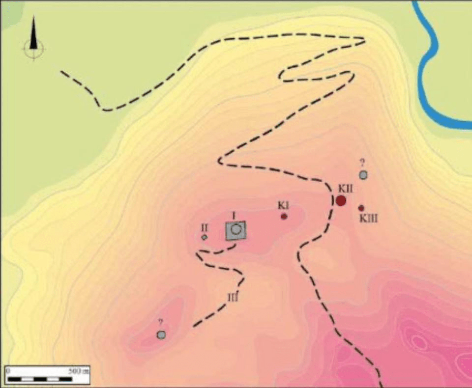
The Pllanica Massif rises to 267m above sea level and dominates the northern part of the Zeta Plain. From the north and west, its slopes are bordered by the Cem River, a tributary of the Morača (Fig. 1). Three stone tumuli form a distinct group of structures identified on Pllanica Hill. They are located on the ridge of the hill, in its eastern part, below the summit.
The small tumulus, marked as No. I, lies in the middle of the ridge. Tumulus No. II, the largest and most prominent, is situated at the eastern end, while the small tumulus No. III is located to its southeast, further down the slope. Their arrangement is approximately linear, with Tumulus II in the middle (Fig. 2–3). This may be intentional or simply the result of the terrain formation and access at the top of Pllanica. Size and state of preservation vary from one tumulus to another.
In these ancient tumuli of Pllanica, the traces of a world much older than today’s borders are clearly felt — the Illyrian world. These stone mounds are not merely graves, but evidence of a strong, proud civilization deeply rooted in these lands.
The Illyrians who lived in this region were not just occasional inhabitants of mountains and plains, but people who knew their land, defended it, and honored it with rituals, stones, and eternal memory. In these tumuli speaks the silence of a people that was not extinguished, but became the foundation of our history.
Here in Pllanica, every stone appears as a witness to a time when honor, land, and Illyrian identity were sacred. And this heritage remains today a powerful reminder that our roots in these lands are deep, ancient, and unbreakable.
Figure Captions:
Fig. 1. The Pllanica Massif viewed from the northeast.
Fig. 2. Pllanica: position and connection between structures on the hilltop. The tumuli are marked in red with the letter “K”. Modern structures are marked in gray.
Fig. 3. Bird’s-eye view of the hill ridge, showing the location of Tumuli No. I, II, and III.
Fig. 4. Tumulus No. I – orthophotographic map.
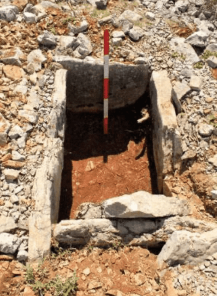
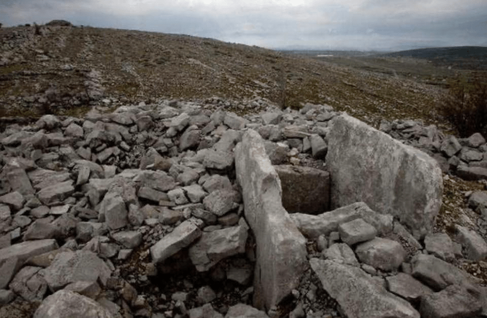
Fig. 5. Tumulus No. I – the sarcophagus (ancient coffin) after excavation.
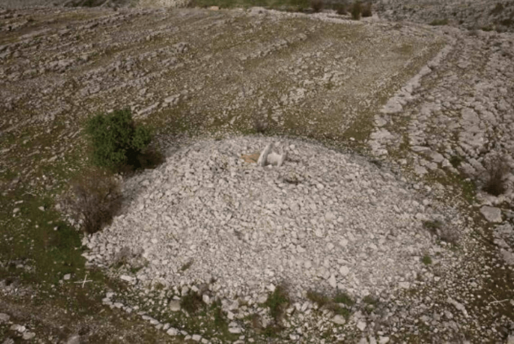
Fig. 6. Tumulus No. II – bird’s-eye view.
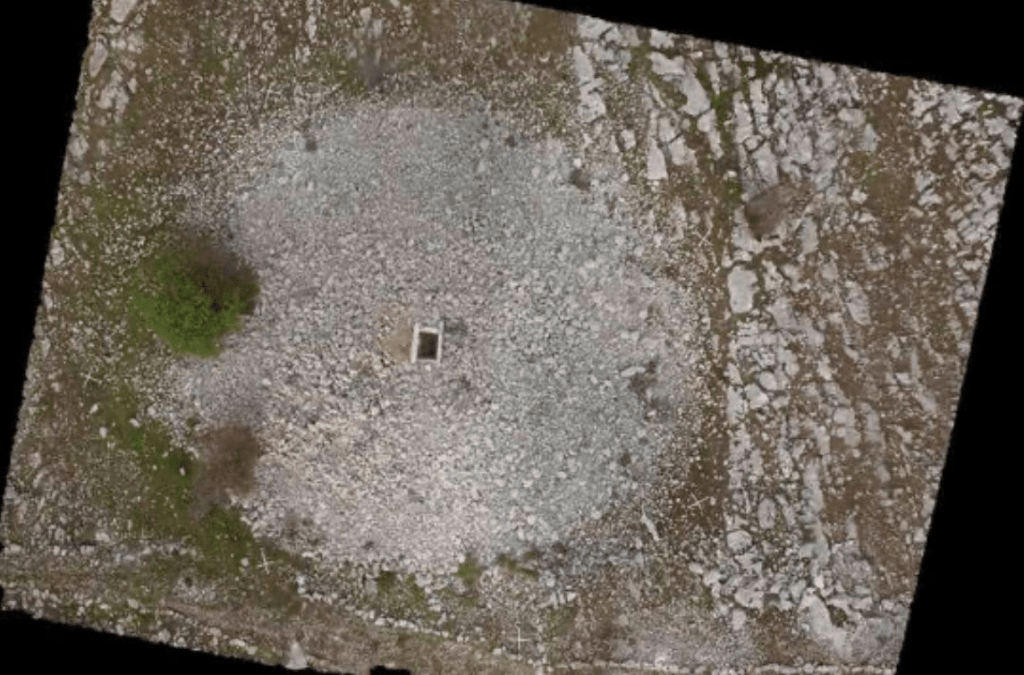
Fig. 7. Tumulus No. II – orthophotographic map.
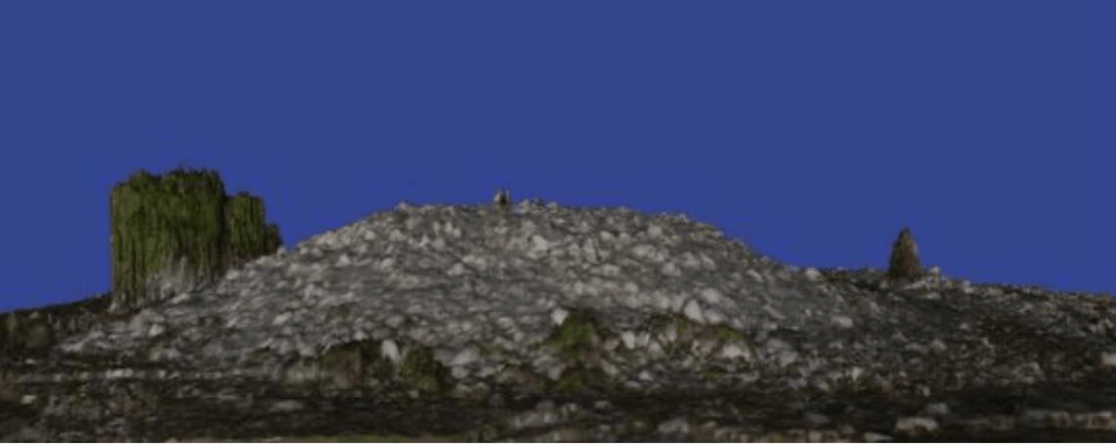
Fig. 8. Tumulus No. II – digital elevation model (DEM), view from the west.
Fig. 9. Tumulus No. II – the top of the tumulus with the sarcophagus.
Fig. 10. Tumulus No. II – the sarcophagus after excavation.
Fig. 11. Tumulus No. III – orthophotographic map.
Fig. 12. Tumulus No. III – general view. In the foreground is the lid of the sarcophagus.