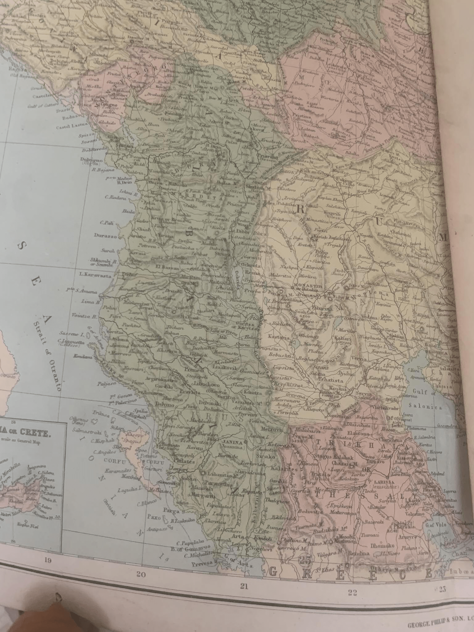
How Large Were Albanian Territories in the Early 20th Century?
The vintage map from the George Philip & Son atlas (c. 1910–1925) offers a striking glimpse into the Balkans just before and after Albania’s declaration of independence in 1912. What it reveals is that the territories inhabited predominantly by Albanians were far larger than the small state that emerged.
The Scale of Historical Albania
At the turn of the 20th century, Albanian-inhabited lands stretched across much of the western Balkans. They included:
Modern Albania (the core)
Kosovo (then part of the Kosovo Vilayet)
Western North Macedonia (including areas around Tetovo, Gostivar, Debar, Struga, and Ohrid)
Southern Montenegro (Ulqin, Tivar, Plav, and Gucia)
Parts of southern Serbia (Preshevë Valley and areas toward Nish)
Chameria (Çamëria) in today’s northwestern Greece (from Preveza to Ioannina region)
Under the late Ottoman Empire, these regions were administratively organized into four main vilayets with strong Albanian majorities or pluralities: Scutari (Shkodër), Kosovo, Monastir (Bitola), and Janina (Ioannina). Together, these territories covered roughly 80,000 to 120,000 square kilometers — significantly larger than the 28,748 km² of the present-day Republic of Albania.
When Albania declared independence on November 28, 1912, the Great Powers (Britain, France, Russia, Austria-Hungary, Italy, and Germany) redrew the map at the Conference of London (1913). Fearing a strong Albanian state and rewarding their Balkan allies, they awarded:
Kosovo and large parts of Macedonia to Serbia
Southern Albanian territories to Greece
Northern areas to Montenegro
As a result, more than half of the Albanian population and territory remained outside the new state’s borders. This fragmentation created lasting divisions that still influence Balkan politics today.
The Map’s Testimony
The Philip & Son map, with its Italianate names like Durazzo, Scutari, and Monastir, captures this transitional moment — the final decades of Ottoman rule and the painful birth of modern Albania. It reminds us that “Albania” in the early 20th century was not a small coastal country, but a substantial ethno-geographic reality stretching deep into the heart of the Balkans.
Today, while modern Albania is modest in size, the memory of those wider historical territories remains a powerful element of Albanian national consciousness.

