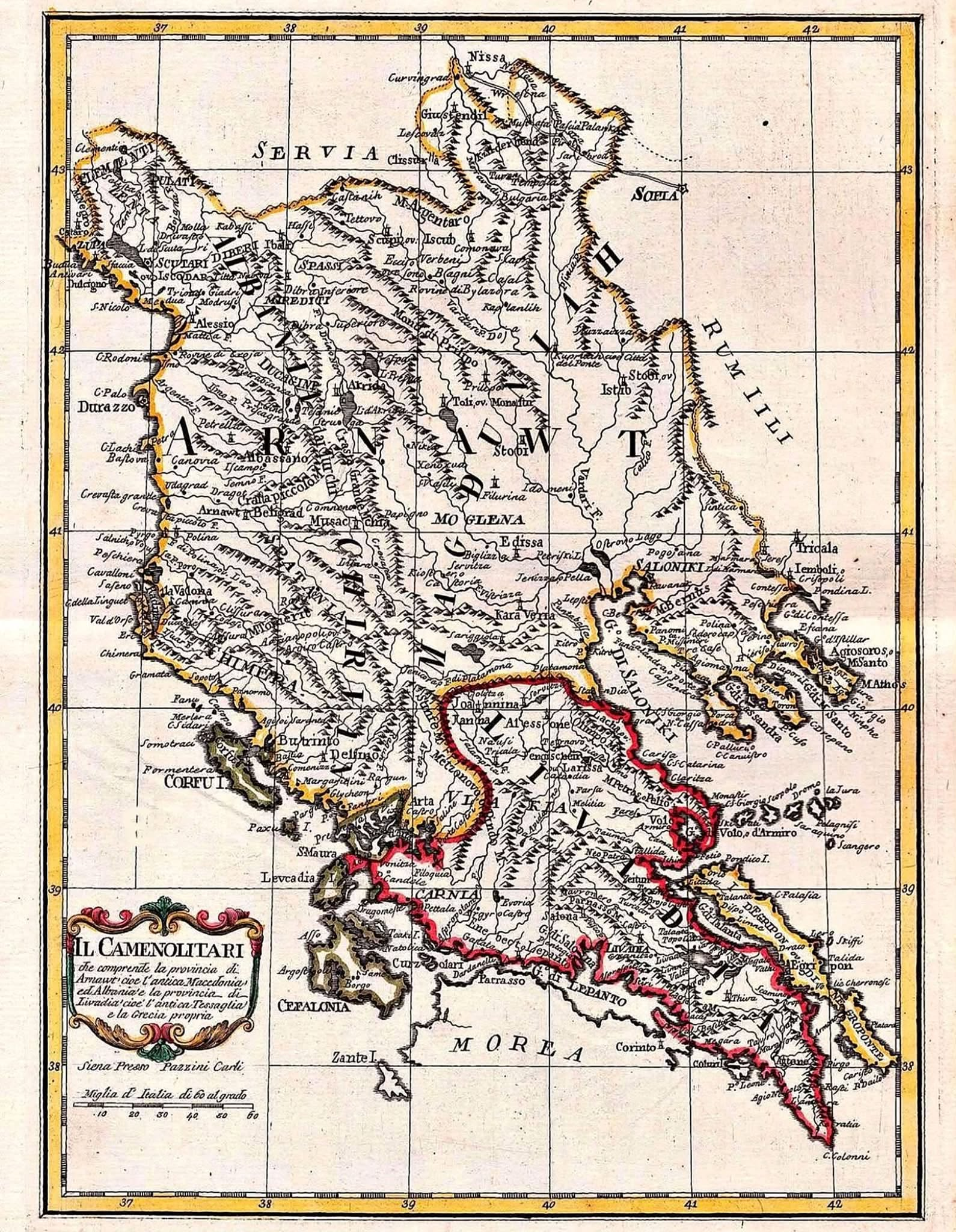

This map is 238 years old and was drawn by Italian cartographer Bartolomeo Borghi and printed in Siena in 1788. Written on the map is “Arnaut”.
“Arnaut” was the name by which Albanians were known throughout the Ottoman world and across Europe. And on this map, the province of Arnaut covers what the cartouche itself calls “l’antica Macedonia ed Albania” — ancient Macedonia and Albania — reaching from Shkodër and the Malësia highlands in the north down past Ohër and toward Selanik (Thessaloniki).
To the south, Borghi draws Livadia: ancient Thessaly and Greece proper. Two provinces, two peoples, clearly distinguished — and Arnaut was the larger. This is not a modern claim. It was how Europe understood Albanian lands more than a century before today’s borders were drawn. Albanian-speaking communities lived across present-day Albania, Kosova, western Macedonia, parts of Montenegro, Sanxhak, the Presheva Valley and beyond — long before political frontiers cut through them.
Source
Bartolomeo Borghi. Carli Pazzini: “Il Camenolitari che comprende la provincia di Arnawt, cioe l’antica Macedonia ed Albania e la provincia di Livadia, cioè l’antica Tessaglia e la Grecia propria”

